In February, Google
posted on its lat/long blog that they had uploaded new imagery for more than a hundred different countries. Better yet, they released a KML file that showed the locations of updated imagery including, rural Chad, new housing developments in Burkina Faso, N'djili Airport in DRC - all sorts of interesting stuff. In fact, you should check it out by
clicking here and downloading and viewing the KML.
Better still, this prompted me to take another peek at the Village of Pommern, which I finally found on Google Earth a
few months back.
It turns out that the imagery has been significantly improved. So much improved that I could clearly see the outline of the cafeteria extension we were working on back in 2009. It is in the center of the map below.
View Larger Map
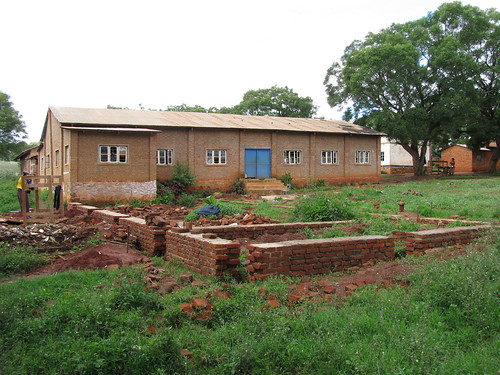
Here's a picture of the area as it looked when we were working on it.
So that's fun.


Cool dude!
ReplyDelete