Tuesday, August 30, 2011

A Weeklong Search Party for Pommern, Tanzania

After returning home from Tanzania in 2009, I quickly took to Google Earth only to be disappointed by the fact that the image quality was poor and I couldn't pinpoint my location. The resolution was so poor I couldn't even find the Village of Pommern.

Even a few years removed from my trip I have a pretty good mental map of the area. When I returned home I estimated the location based on blurry images of maps, estimated travel times, and the turns I remembered on our ride from Iringa to Pommern. I thought I was close, but the imagery was so bad that I had no way of knowing. Now I've lost that Google place mark and so it's like starting from scratch.

This weekend I discovered that the majority of the Iringa Region in Tanzania has new, clear, crisp imagery for a large area.

Up to this point it has been unbelievably difficult to locate the village. While the other village in Tanzania associated with Global Volunteers (Ipalamwa) shows up, Pommern never has. Given that I was teaching geography and computers in Pommern it's frustrating that it's nearly impossible to locate the village in Google Earth. Although it's not as if there is internet in Pommern. For that you need to go to Iringa, where the chicken is much smoother.

I found a Facebook Group that said the secondary school, which I worked at, is 58KM from Iringa.  I'm inclined to believe that distance is via the road network.  Going out 58KM as the crow flies would lead into the adjacent Region of Morogoro.

I knew that Pommern was in the Kilolo district of Iringa, one of seven districts but I can't find any maps that show those district lines.  That is particularly disappointing.  I guess the internet is not yet complete.

I've challenged myself to find Pommern and locate it for others.  Based on the information I've gathered I've developed a very generous search area of approximately 1,000 square miles. I'm very confident that Pommern is within the search area.
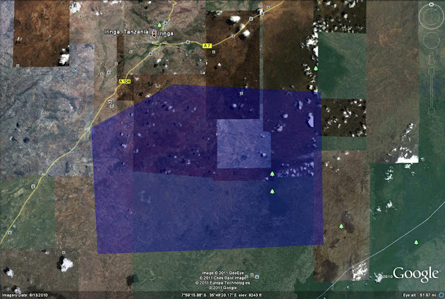
Admittedly, this seemed like a much easier endeavor when I first drew the search area. It's sort of like being able to stumble upon my subdivision from a map of metro Detroit. 

When I do find it I'll be able to greatly increase the accuracy of some geotagged photos in the area. Bonus!

It's quite a challenge but I think I have it in me and THAT means next week you can bet there will be a post and a link to all the features I've found and remembered. Hopefully it will give more of a voice and online presence to a great area, a great Place.


Monday, August 22, 2011

Belle Isle

This weekend I took a drive to Belle Isle, the 1,000 acre mega park in the Detroit River just a couple miles from the center of downtown. It's a pretty cool place despite being a tad run down. It seems to be utilized for family reunions more than anything else, and really, that's not so bad.  From time to time, the park does attract special events and even large events, such as the old (ol') course for the Detroit Grand Prix.  Unfortunately, while it's a destination for many, the fact that it doesn't generate enough money to sustain itself is an issue for a city facing annual multimillion dollar deficits.  Not that a park should be revenue neutral, but rather, based on the adjacent land use and its proximity to...things, it'd be hard to find an equal benefit. 

Another reason that Detroit should be the studio/capstone class for any urban planning program.


View Larger Map

Even though Belle Isle is in need of a sprucing up, I can imagine the cost of upkeep is still very high. So there is the constant back and forth arguing over whether or not to charge admission to the park (or a toll for the bridge) and whether that will price people out or dramatically reduce utilization.

If you're interested, go ahead and take a peek at the recreation budget for Detroit.  Belle Isle Operations account for about 1 million out of 19 million. Although in fairness to my naivety, I feel like I'm missing something in my reading of the Recreation "budget". 

It's a park...parks belong to the people...It's part of being a civilized society...don't charge.

It is, however, just another example of the great things Detroit has going for it. Just think, Detroit has an island park bigger than Central Park...yea...I didn't realize that either.  The potential is amazing and there is no shortage of ideas. But it sits, in more or less the same state it has been in for years. Aging.

The gem on the gem is the Conservatory.  An interesting building indeed.  I don't know if it's beautiful, or just art deco, or what.  The lighting wasn't perfect on Saturday, but I created this from a few pictures I took on Saturday. Pretty cool, eh?

Conservatory

Obviously, this Detroit stuff is occupying my mind, and it's a GREAT thing to be talking about.  I want to point out a great response to last weeks post.  Check out the comment by Matt.  Spot on. Kudos.


Monday, August 15, 2011

Images of Detroit

I've been writing about Detroit a lot lately, and that's because I have been thinking about it a lot. Fixing it is the enigma of the planning field. Its problems represent some of the most fundamental ones facing US cities today.  I did go back this weekend to take some pictures of Detroit and I've included a few of them here. It's still a great city with a lot going on, but I'm lost as to what I can do to make it better.

When is the last time you were in Detroit?  What do you think should be done?  If you've never been to Detroit, what impression do you have of the city?


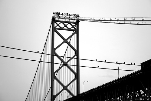
Ambassador Bridge
Ambassador Bridge

Train Tracks in River Rouge
Rubble
Brush Street
Brush Street - NOBODY
Tire and Garbage near Ambassador Bridge


Monday, August 8, 2011

Delray and Southwest Detroit

Delray
I spent about an hour this past Sunday driving around the southwest Detroit area.  It's been a long time since I've been to that area of the City and I went to a few places I'm sure I've never been.  I started in the heart of the CBD and headed to the southwest on Fort Street, eventually heading further south and west until I was on Jefferson.  I was amazed by what I saw.  I knew Delray was a bit decayed but I never realized how much vacant land there is in the former village.  Every few blocks was a vacant expanse of overgrown weeds, full of garbage and who knows what else.  Many of the streets look eerily similar to this image of Anystreet, Delray.  While there was the occasional person sitting on the occasional porch, the area felt abandoned, even for Detroit.  It was a Sunday afternoon but I would go several minutes at a time without seeing another car - something you'd be hard-pressed to do even in rural areas of southeast Michigan.  Roads would seemingly dead end to the heavily industrialized areas, a sign of their one time vibrancy.   What remains is a sad reminder of the magnitude of need for Detroit.

Jurisdictional boundaries seem to matter less on the southwest side of Detroit.  Whereas the Northern border of Detroit, 8 mile, cuts a fine line between urban/suburban and white and black, the border is much more blended to the southwest. I didn't realize I wasn't in Detroit until I was in Ecorse, two communities further south and that was only because I saw an Ecorse sign.

So what I'm left with is a place that has jumped to the top of the I-need-to-take-a-friend-and-a-camera-and-take-pictures list. And when I manage to take those pictures, they'll show up here.


Monday, August 1, 2011

What You See is What You Google Earth

I'm quite sure I've made this clear before but I'm not a programmer.  However, since I've stared at it long enough I'm able to at least git the jist of things like HTML and KML.  Sooner or later I'm going to get around to creating some cool stuff on Google Earth but in order to do that I need to learn more about writing KML, not just being able to (sorta) understand it.

Today I was searching around and came across Google's KML Interactive Sampler.  It's a what you see is what you get (WYSIWYG) KML editor.  I assume something similar to this has been around for some time but I've never seen it. (I looked - the interactive sampler has been around for a couple years)


What's really nice about this tool is it works as a built in text editor and provides full-fledged text examples of a number of features in the KML language. A quick browse revealed the polygon fade object...or command...or whatever the correct term is, which will serve as my "thing I learned today".

Even if you haven't experienced with HTML, XML or KML you really should take a couple minutes to visit the WYSIWYG interactive sampler. Click on the folders on the left and examine the text that pops up in the middle of the page.  Edit a few of the lines and see how it affects the view in the panel on the right. Remember you'll need to hit the "Update Earth" button for your changes to register.

Don't worry, it won't actually change the earth. That power is reserved specifically for Sergey and Larry. Maybe one of them made the coast of Greece pink. :)