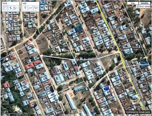
I don't recall exactly what brought me to the Google Map Maker tool most recently but I ended up editing a map of Iringa, Tanzania. If I can't do it for home, Iringa is one of my first "go-tos" for creating things geography and google related, and lets face it, Google map maker is about as close a match for that criteria as I'll ever find.
It might seem that the community maps in Africa as part of Google's effort to map Africa would need a lot of work, particularly outside of capital cities but several efforts by google have extended the accuracy of these user generated maps to much more rural areas. Well, perhaps smaller cities is more accurate. The Google Africa Blog talks about one of these efforts:Official Google Africa Blog: Mapping Korogocho. While there is some educational benefit that comes with trainings like this, in the end, Google is the big winner.
I was impressed by the accuracy of most of the roads in Iringa. All but a few outlying dirt roads were included and for the most part the accuracy matched up well with the satellite imagery.
While not as intuitive and arguably not as simple as Google's Building Maker, Map Maker offers much of the same fun factor. It is rewarding to know that you are contributing to a more completely and accurately mapped world that is more accessible to the masses than ever before.
That's the good.
As I moved away from the center of Iringa I noticed that many of the roads are misaligned by 30-100 feet. Map maker does not let you do multi-editing which prevents you from aligning a segment of road. This means, you can fix the location of an intersection or you can fix the alignment of a road but you can't do both. Since there is no easy way to track a large number of edits in an area it becomes a fools errand (I'm not actually sure I'm using that idiom correctly, but it seems to fit) to try to fix misaligned roads- and there are a lot of them! So here I am complaining that I can't help Google for free, faster.
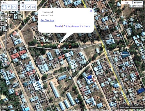
Here is an example where I fixed two intersections but was not able to fix the road (segment) connecting them because the segment had adjacent edits pending review. The two small red edit points are my approved edits. Noticed I arranged them based on the imagery. I could not edit the segment of road between these two edits at the same time.

In order to complete the edit, I need to now fix the two remaining intersections...one at a time.

I have to hand it to Google. Much like building maker, they have crowdsourced some of the most detailed grunt-work to the world for no cost. Those U of M grads are really on to something with this Google thing.
As frustrating as actually making a lot of edits can be, I see myself doing a lot more with map maker, especially in Africa.


No comments:
Post a Comment