
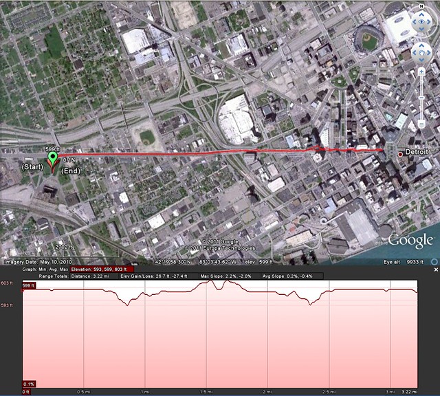
I uploaded the recorded run track from my phone and emailed it to myself as a kml file with a few quick commands. As I reviewed the track for accuracy, or at least consistency of the altitude, I was amazed at how closely the hills matched up, especially since this is only dealing with about ten feet of variation.
While I foolishly allowed myself to think this was a sign my phone's GPS was amazingly accurate, I quickly figured out it was, in fact, just another clever use of other Google data, the terrain model data from Google Earth.
Notice the terrain map of the out-n-back race format is almost a mirror image. My GPS might not be state of the art, but the Google terrain data fills in with a great dataset that will suffice for almost any project!
It's just another example of how easy Google is making things for us by making their products interact seamlessly.


No comments:
Post a Comment