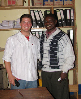
The form 3 students in the tiny village of Pommern, Tanzania outside of Iringa repeated the mantra over and over. Edward, my favorite teacher (pictured with me below right) at the school reminded me that repetition was key to drilling anything new into the kids' heads.
Their exclamation was in response to my question. What are the main types of map distortions?!
Shape! Size! Distance!

Before the class started I found a scuffed up old soccer ball, still smelling of the cow dung it had rolled through the day before on the soccer field- excuse me-pitch!
I've always felt the best demonstration of map distortion was to use a ball and a piece of paper. I folded the paper around the ball to show how the page itself became distorted then highlighted those areas by rubbing pencil lead on the folds.
I straightened the paper to show the distortions when the sphere is projected in two dimensions. Some of the students understood but map projections can be one of the most difficult spatial issues to grasp; But it is paramount to understanding ones place and relative placement on the earth.
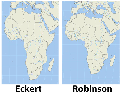
 I remember as a child certain world maps making Africa look tall and skinny. Something didn't sit right with me when I saw that particular projection. It turns out that projection was an equal area projection like the Eckert IV shown in contrast with a Robinson projection in the image, left. The Robinson projection is easy on the eyes and just feels right.
 Wouldn't you agree?
After a heads up from Matt Rosenberg in his post on the about.com site, I found a great website which uses radical map projections to view data in a new and exciting way.
Projections help us display the spheroid earth on a two dimensional surface. My favorite projection for world maps and the one used by the greats at national geographic is the Winkel tripel projection, a variation on the Robinson projection.
In one post ten projections are layered on each other to show the variations.
Since I mentioned National Geographic I'm excited to tell you that I have received an initial response from the company regarding my inquiries to the map policy committee as well as the Hala'ib triangle. I'll be sure to update you on what I ultimately discover.
I really hope you check out some of the amazing maps at radicalgeography.com.


No comments:
Post a Comment